
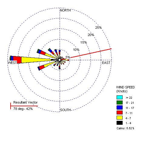
 Windrose maps represent the direction of the wind at certain speeds. Based on the length of each vector, you can determine the frequency of the wind at that speed and direction. The above map is based on the wind in Yakima, Washington.
http://www.climate.washington.edu/climate.html
No comments:
Post a Comment